
Select NOAA-NWS Forecast Office Text Products
(Product availability varies with seasons, forecast office, and weather.)
Forecast Discussion for Chicago, IL
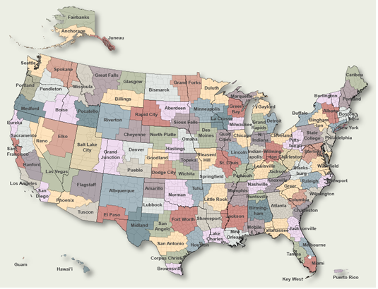
To Select Another NWS Office Click on Map or Choose from List
|
| Select Forecast Office: | Select Product: |
520
FXUS63 KLOT 021126
AFDLOT

Area Forecast Discussion
National Weather Service Chicago/Romeoville, IL
626 AM CDT Sat May 2 2026

.KEY MESSAGES...

- Rain showers are expected in the area on Sunday, followed by a
  30-50% chance for thunderstorms Monday night. If storms occur
  Monday night, a few could become strong to severe (primarily
  near and south of I-80).

- Outside of a brief warmup Sunday into Monday, near to below
  normal temperatures are favored through next weekend with
  occasional chances for rain showers.

&&

.DISCUSSION...
Issued at 256 AM CDT Sat May 2 2026

Aside from the frost and localized below freezing temperatures
this morning, today is looking be a pretty uneventful day
weather-wise with surface high pressure drifting through the
region. Temperatures will climb from the 30s this morning into
the 50s this afternoon, though a lake breeze may keep some of
our lakeside locales just below the 50 degree mark. Increasing
mid- and upper-level cloud cover tonight will prevent Sunday
morning from featuring a repeat of this morning`s frost, though
still couldn`t completely rule out some patchy frost
development in our far southeastern CWA, which will have more
time to spend underneath clear skies compared to areas farther
to the north and west.

Sunday morning, the upper-level shortwave responsible for the
increasing cloud cover will arrive in earnest. The ascent
offered by the shortwave, augmented by low- to mid-level
frontogenesis and isentropic lift, will drive some rain showers
through the area during the morning and early afternoon without
much additional fanfare. The descending hydrometeors will still
have to work through a wedge of dry air below 700 mb in order to
reach the ground, and it remains plausible that areas removed
from the main mesoscale axis of frontogenetical forcing will see
little to no precipitation as this activity moves through the
area. Nevertheless, with deterministic and ensemble guidance
converging on a common solution with measurable precipitation
occurring in at least a portion of our forecast area, an
increase in PoPs during the daytime hours on Sunday was
warranted. The earlier arrival time of this shortwave and an
associated weak cold front will likely relegate most of any
threat for thunderstorms during the late afternoon and evening
to our south and southwest, though it still couldn`t be ruled
out at this time that at least some attempts at convection occur
closer to home while the front still hasn`t fully cleared our
forecast area.

The low-level pressure gradient will also compress on Sunday as
the surface pressure trough associated with the cold front
encounters the influence a ~1020 mb surface high centered over
the southeastern CONUS. This will yield breezy southwesterly
winds across our area that will likely gust in excess of 30 mph
at their peak and push air temperatures into the 60s (and
possibly even into the low 70s) after the earlier rain showers
depart. These southwesterly breezes will continue into Monday as
a deeper surface low associated with a more pronounced upper-
level trough dives southeastward from the Canadian Prairies
towards Lake Superior. Continued warm air advection off of these
winds will propel temperatures into the 70s south of another
inbound cold front on Monday, while also inducing an influx of
better low-level moisture that will bring increasing chances
for showers and thunderstorms to our area.

It appears that there will be two main areas/forcing mechanisms
that we`ll need to monitor for convection late Monday afternoon
and evening. One area will be along the aforementioned cold
front, which may not reach our CWA until after sunset based on
most of the latest deterministic model runs. By this point, an
already modest axis of MLCAPE along/ahead of the front will
become further depleted, putting into question how long any
frontal convection that developed during and just after peak
heating in the afternoon can sustain itself into the evening.
Additionally, a southwest-northeast oriented low-level jet
centered just to our south/southeast and juxtaposed by better
(but still not exactly stellar) low-level moisture and
instability will likely try to force convection in or near our
southern counties as it strengthens during the evening.
Eventually, the cold front will encounter the slightly higher
dew points across our southern CWA and cross paths with the low-
level jet, but this may not happen until late in the evening or
during the early overnight hours -- by which point, the
available instability coincident with the better moisture will
have likely dwindled quite a bit.

Thus, while thunderstorms remain possible on Monday, a lot of
uncertainty remains with whether everything will come together
just right for them to occur, and it`s not a sure thing yet that
they will occur in our area. That said, if storms do end up
occurring here late Monday, then 30-40 kts of deep-layer shear
would support the potential for some degree of storm
organization. This would particularly be the case across
southern portions of our forecast area, where the Storm
Prediction Center has delineated a level 1/5 severe thunderstorm
risk in their latest Day 3 Convective Outlook.

Shower and storm chances may continue into Tuesday amidst
cooler post-frontal temperatures with plentiful large-scale
ascent overspreading the frontal zone that should still be
situated in close proximity to our forecast area. Aggregate
troughing and northwest flow over the Great Lakes and Midwest
will then be the theme for the synoptic upper-level pattern for
the latter half of the week and into next weekend. This will
favor the persistence of near to below normal temperatures and
should allow for additional periodic opportunities for rain
showers in the coming days as more disturbances embedded within
the mean longwave troughing and northwesterly flow aloft dive
into the region.

Ogorek

&&

.AVIATION /12Z TAFS THROUGH 18Z SUNDAY/...
Issued at 626 AM CDT Sat May 2 2026

Primarily VFR conditions expected through the TAF cycle. A lake
breeze is likely to form this afternoon, but westerly component
to the winds will probably keep the lake breeze east of ORD and
MDW. If westerly winds are weaker than expected this afternoon,
then there would be a chance that the lake breeze could make it
farther inland resulting in a wind shift to easterly at MDW and
ORD. Best chance for a brief easterly wind shift looks to be
early this evening as west winds ease at sunset, potentially
letting the lake breeze make a run westward across ORD and MDW
before diurnally dissipating. Confidence was too low in the
scenario to include in the TAFs, but they may need to be
adjusted to reflect this scenario if it appears more likely
later today.

Otherwise winds will become south-southwesterly tonight, likely
increasing and becoming gusty a few hours after sunrise on
Sunday. SCTD showers are expected to move across northern IL
Sunday morning, for now introduced a PROB30 but as confidence
increases this may need to be converted to a TEMPO.

- Izzi

&&

.LOT WATCHES/WARNINGS/ADVISORIES...
IL...Frost Advisory until 8 AM CDT this morning for ILZ003-ILZ004-
     ILZ005-ILZ006-ILZ008-ILZ010-ILZ011-ILZ012-ILZ013-ILZ019-
     ILZ020-ILZ021-ILZ023-ILZ033-ILZ103-ILZ105-ILZ106-ILZ107-
     ILZ108.

IN...Frost Advisory until 8 AM CDT /9 AM EDT/ this morning for
     INZ001-INZ002-INZ010-INZ011-INZ019.

LM...None.

&&

$$

Visit us at weather.gov/chicago
|
Previous Forecast Discussions may be found at
NWS Chicago, IL (LOT) Office Forecast Discussions.
(Click 'Previous Version' there to view past versions successively.
Some may differ only in time posted.)
Products Courtesy of NOAA-NWS
NWS Information Parsing Script by Ken True at Saratoga Weather - WFO and Products Scripts by SE Lincoln Weather.
Mapping by Curly at Michiana Weather and by Tom at My Mishawaka Weather.